DEMOGRAPHICS / AT A GLANCE
Georgia
Population
10,711,908
Total Area
59,441 square miles
Land Area
57,919 square miles
Water Area
1,522 square miles
Shoreline
2,344 miles
Coastline
100 miles
Highest Point
4,784 feet at Brasstown Bald
Lowest Point
Sea level at Atlantic Coast
Topography
Blue Ridge Mountains in northeast and north central; central piedmont extends to the fall line of rivers; coastal plain levels to coastal flatlands.
Bordering States
Alabama, Florida, North Carolina, South Carolina, Tennessee
Area Codes
229, 404, 470, 478, 678, 706, 762, 770, 912
Capital City
Atlanta
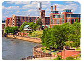
Largest Cities
Atlanta, Augusta, Columbus, Savannah, Athens, Macon, Roswell, Albany, Marietta, Warner Robins
Agriculture
Poultry and eggs, peanuts, cattle, hogs, dairy products, vegetables
Industry
Textiles and apparel, transportation equipment, food processing, paper products, chemical products, electric equipment, tourism
Statehood
January 2, 1788
State Bird
Brown Thrasher
State Flower
Cherokee Rose
State Tree
Live Oak
State Motto
Wisdom, justice, and moderation
State Nickname
Peach State
State Song
Georgia on My Mind
South Carolina
Population
4,961,119
Total Area
32,007 square miles
Land Area
30,109 square miles
Water Area
1,896 square miles
Shoreline
2,876 miles
Highest Point
Sassafras Mountain at 3,560 feet
Lowest Point
Atlantic coast, sea level
Border States
Georgia, North Carolina
Agriculture
Tobacco, poultry, cattle, dairy products, soybeans, hogs
Industries
Textile goods, chemical products, paper products, machinery, tourism
Largest Cities
Columbia, Charleston, North Charleston, Greenville, Rock Hill, Mount Pleasant, Spartanburg, Sumter, Hilton Head Island, Florence
State Capital
Columbia
Statehood
May 23, 1788
State Bird
Great Carolina Wren
State Flower
Yellow Jessamine
State Nickname
Palmetto State
State Tree
Cabbage Palmetto