 |
DEMOGRAPHICS / COLORADO AT A GLANCE
Population
5,758,736
Total Area
104,100 square miles
Land Area
103,730 square miles
Water Area
371 square miles
Highest Point
Mt. Elbert at 14,433 feet
Lowest Point
Arikaree River at 3315 feet
Geographic Center
Park, 30 miles northwest of Pike’s Peak
Topography
Eastern dry high plains; hilly to mountainous central plateau; high ranges of western Rocky Mountains alternating with broad valleys and deep narrow canyons.
Capital City
Denver
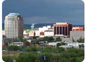
Largest Cities
Denver, Colorado Springs, Aurora, Lakewood, Fort Collins, Arvada, Pueblo, Westminster,
Boulder, Thornton
Area Codes
303, 719, 720, 970
Border States
Arizona, Kansas, Nebraska, New Mexico, Oklahoma, Utah, Wyoming
Agriculture
Cattle, wheat, dairy products, corn, hay
Industries
Scientific instruments, food processing, transportation equipment, machinery, chemical products, gold and other mining, tourism
Statehood
August 6, 1876
State Motto
Nil sine Numine (Nothing without Providence)
State Flower
Rocky Mountain Columbine
State Nickname
Centennial State, Colorful Colorado
State Tree
Blue Spruce
State Bird
Lark Bunting
State Song
Where the Columbines Grow
Search by ListSearch by a list of area regions or city names. |
|
Search by MapUse our interactive map to find your community |
|