DEMOGRAPHICS / AT A GLANCE
Statehood
December 11,1816
Area in Square Miles
36,420
Area Codes
219, 317, 765, 812
Location
39.776N, 086.146W
State Bird
Cardinal
State Motto
The crossroads of America
State Nickname
Hoosier State
Border States
Illinois, Kentucky, Michigan, Ohio
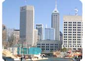
Capital City
Indianapolis
Agriculture
Corn, soybeans, hogs, cattle, dairy products, eggs
Industry
Steel, electric equipment, transportation equipment, chemical products, petroleum and coal products, machinery
Geographic Center
Boone (14 miles northwest of Indianapolis)
Highest Point
Hoosier Hill; 1257 feet
Largest Cities
Indianapolis, Fort Wayne, Evansville, South Bend, Gary, Hammond, Bloomington, Muncie, Anderson, Terre Haute