Hampden County
County Offices
625 Main Street
Hampden 413-566-2151
https://www.hampden.org
Chamber of Commerce
1441 Main Street
Springfield 413-787-1555
https://springfieldregionalchamber.com/
The Connecticut River is at the center of Hampden County, with the cities of Agawam, West Springfield and Westfield located on its west banks and Springfield on the east. The county is home to more than 280,000 residents who live in a wide range of exciting communities from the smallest towns to the “big city” life of Springfield.
Services
Education is an important part of the area with six colleges that have a total student population of nearly 30,000. Public and private education resources in the region are very important. With businesses working together with parents, teachers and educators to develop programs that make the students in the area stand out in the academic ability. Healthcare is also well represented in the county with very highly rated medical facilities such as Baystate Medical Center, Mercy Hospital and Shriners Hospital for Children. County residents receive some of the most advanced medical care and services available anywhere. The County’s location also offers resident and easy commute, with several major highways serving the area.
Lifestyle
Hampden County offers everything its residents could want. The museum complex at The Quadrangle includes the Museum of Fine Arts, The George Walter Vincent Smith Art Museum, the Connecticut Valley Historical Museum, the Springfield Science Museum and the Dr. Seuss Museum. Symphony Hall and City Stage bring some of the best professional theatre to the county. The Springfield Symphony Orchestra also calls Symphony Hall “home” and plays to ever-larger audiences. The Springfield Civic Center is busy with activity throughout the year, including the home games for the Springfield Falcons ice hockey team.
The Naismith Memorial Basketball Hall of Fame, an international tribute to the great heroes of the game that was born in Springfield, anchors the riverfront redevelopment project. For families there is also the Zoo at Forest Park which includes over 200 different animals on display. The region is also home fairs and festivals, capped with the Big E. The Eastern States Exposition is New England’s country fair, and attracts more than one million people to West Springfield every September. Hampden County offers everything that a family might look for in a place to call home.
Agawam
Municipal Offices
413-786-0400
https://www.agawam.ma.us
Chamber of Commerce
413-787-1548
https://ourwrc.com/
Incorporated in 1855, Agawam was the site of the first homestead built in Western Massachusetts. Modern residents enjoy a suburban community that blends charming New England tradition with outstanding contemporary opportunities. Striving to maintain its small town, rural charm, the community is brimming with civic activities, school affairs, and sporting events. Situated among an exquisite setting of mountains, rivers, streams, wetlands, and expansive farm fields, Agawam residents enjoy the tranquility provided by scenic vistas and wide open spaces. Elegant historic homes and charming village centers define the town’s intimate, friendly atmosphere. Agawam is bordered on the east by the Connecticut River and on the south by the State of Connecticut. The regional attractions of Six Flags, the largest amusement park in New England, as well as the wooded Robinson State Park draw visitors and vacationers.
Blandford
Town Hall
413-848-4279
https://townofblandford.com/
Chamber of Commerce
413-534-3376
Blandford is situated in the eastern foothills of the Green Mountains. It is a rural hill town on the historic western corridor between Connecticut and the Housatonic Valley. This was an important military highway from New York during the revolution as is testified by the number of taverns that were recorded on the post road servicing travelers. The town was originally cut up into lots and sold to Scotch-Irish Presbyterians who immigrated from Hopkinton and created an agricultural based economy. There were some early tanneries, paper and card board mills, but the major industry in the 19th century was dairy farming. Blandford led the county in cheese production in 1845 and then again 1870 and despite becoming a favored summer resort for Springfield and Westfield families, has remained in today a community of dairy farms and orchards. The town has retained a cluster of notable buildings in its center, including a Greek revival church. Residents enjoy a relaxed pace of life and have a strong sense of community. Blandford today is a great place for families to call home.
Brimfield
Town Hall
413-245-4101
https://www.brimfieldma.org
Chamber of Commerce
413-283-2418
http://www.quaboagvalley.org/
Brimfield is a very traditional rural New England community set in a beautiful valley. The town has a wonderful l Town center in the tradition of American small towns. While a quiet and unassuming town most of the year, Brimfield is nationally famous for its three annual flea markets during which the whole community becomes an open air bazaar and visitors come from all parts of New England to browse among almost hundreds of acres of stalls and vendors, with more than 5000 of them, loaded with antiques, quilts, china and silver. The usual annual population of 3,000 residents increases to tens of thousands for the days of the Brimfield Fair. All of the town meetings are held in the original historic Town Hall. Brimfield is a great place to bring a family for the small town feel and feelings of a better time gone by.
Chicopee
Municipal Offices
413-594-1400
https://www.chicopeema.gov
Chamber of Commerce
413-594-2101
https://www.chicopeechamber.org
The City of Chicopee is conveniently located at the junction of the Massachusetts Turnpike and Interstate 91. This area is home to Westover Air Force Base, employing approximately 1,000 of the local residents. A diverse urban community, Chicopee claims many structures that are refurbished 19th-century industrial buildings. Cabotville Industrial Park is actually an impressive collection of 19th-century brick buildings that house a variety of small and medium-sized industries. The city’s historic district, Chicopee Center, is brimming with stately homes that have been carefully maintained over the years. Celebrating of its colorful past and eclectic heritage, Chicopee hosts several annual events throughout the year. An historic shad run on the Connecticut and Chicopee Rivers draws thousands of fishermen to the city each spring, and the area hosts one of the nation’s largest Polish celebrations. The Great New England Air Show attracts as many as 700,000 people to Westover Air Force Base biannually.
East Longmeadow
Municipal Offices
413-525-5400
https://www.eastlongmeadowma.gov
Chamber of Commerce
413-787-1548
https://explorewesternmass.com/
East Longmeadow was originally settled in 1744 by colonists who tilled the Connecticut Valley’s fertile soil. Perched on a hilly terrain with rich sandstone deposits, the area later became a quarry center that produced quality sandstone for the Trinity Church in Boston and the Bobst Library at New York University. Today, East Longmeadow is still recognized as a suburban industrial town. There are presently residential, business, and industrial zones scattered throughout prosperous East Bridgewater and expanding development continues in previously rural areas. East Longmeadow is bordered by Enfield and Somers, Connecticut on the north, Hampden on the east, and Wilbraham on the northeast. Located just five miles from the center of Springfield and 88 miles southwest of Boston, East Longmeadow enjoys a prime location. Major arteries serving the area include State Routes 83, 186, and 220.
Granville
Municipal Offices
413-357-8585
https://www.townofgranville.net
Chamber of Commerce
413-787-1548
https://explorewesternmass.com/
Best known for its harvest delights, Granville is characterized as a primarily residential community surrounded by agricultural fields, wild blueberries, and orchards of Macintosh apples. The area is also known for its delicious cheese products. Granville is also a community of artists, from talented potters to visual artists, writers, hand-crafters, antique dealers, and home-based entrepreneurs. With its panoramic countryside setting, Granville offers year-round natural beauty. Acre upon acre of apple blossoms dot the landscape each May, a fiery canopy of orange and red maple leaves blankets the town each fall, and pristine snow covers the ground in the winter. Although rural in atmosphere, Granville enjoys easy access to surrounding communities and important amenities and services. Just 18 miles from Springfield, Granville utilizes Route 57 as its major thoroughfare, a highway that connects with State Route 189 and U.S. Highway 202.
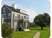
Hampden
Town Hall
413-566-2151
https://www.hampden.org
Hampden is a small country town captured by the gentle hills and sloping mountains that surround it. It is located 10 miles southeast of Springfield, 48 miles southwest of Worcester, 82 miles southwest of Boston, and 152 miles from New York City. This location is ideally suited for quick access to the urban amenities these areas offer. The Scantic River meanders through town reminding residents of the old plow shops, tanneries and blacksmith shops that were once common in the area. Today the area is a mix of new homes and old homesteads. The population of just under 5000, enjoys a great quality of life and is surrounded by natural beauty. The Wetlands in the area are a special attraction and the center point of the Audubon Society’s Laughing Brook Wildlife Sanctuary, built around the former home of Thornton W. Burgess, well-known author of children’s nature books. Hampden retains that feel of the old days where neighbors know each other by name and it’s not unusual to see couples and families walking quietly down the road.
Holyoke
Municipal Offices
413-322-5520
https://www.holyoke.org
Chamber of Commerce
413-534-3376
https://www.holyokechamber.com/
The City of Holyoke is situated along the Connecticut River at the point where the first of several dams was constructed in 1848. At one point in its history, Holyoke produced the greatest tonnage of paper of any city in the world. While only one company continues the operation today, the dam, the canals, and many of the former commercial structures remain in tact. Some buildings have been renovated and reused to take advantage of the city’s prime location at the junction of Interstates 90 and 91. Holyoke is also known as “The Birthplace of Volleyball,” a game that was invented in 1895 by William G. Morgan at the Holyoke YMCA. Visitors can visit the Volleyball Hall of Fame for a closer glimpse of the game’s history and development. Other community attractions include the Wistariahurst Museum, the Children’s Museum at Holyoke, and Heritage State Park. Each year, the park hosts “Celebrate Holyoke,” a three-day extravaganza featuring nationally known performers.
Longmeadow
Municipal Offices
413-565-4110
https://www.longmeadow.org
Chamber of Commerce
413-787-1548
https://explorewesternmass.com/
First settled by Springfield residents in the late 1640s, Longmeadow has emerged as one of Springfield’s most affluent and desirable suburban communities. With no significant industrial development, Longmeadow offers an attractive bedroom community that blend beautiful older homes with vibrant new construction. The town is proud of the handsome period houses showcasing Colonial and Federal architecture near the village green as well as the historic 19th-century houses in the gracious estate district of Forest Park. The triangular intersection of Bliss and Williams streets serves as the town center, home to the high school, public tennis courts, and the primary commercial district. Boasting an enviable location, Longmeadow is situated along the primary corridor between Springfield and Hartford, Connecticut. Longmeadow is 93 miles southwest of Boston and only 23 miles north of Hartford.
Ludlow
Municipal Offices
413-583-5600
https://www.ludlow.ma.us
Chamber of Commerce
413-787-1548
https://explorewesternmass.com/
Touted as a progressive suburban community, the Town of Ludlow enjoys a prime location situated in the northwest corner of metropolitan Springfield. The town is bordered by several communities including Chicopee on the west, Granby on the north, Belcherton to the northeast, and Wilbraham and Springfield on the south. The Westover Industrial Airpark is located to the northwest, and Ludlow has successfully established both industrial and retail expansion. In spite of economic growth, the town has maintained a pleasant community atmosphere. Amenities include both a community hospital, a good local school system, an active Boys and Girls Club with many special programs, two golf courses, and several lush community parks. Residents are just minutes away from cultural and entertainment facilities in the greater Springfield area, with easy access to both the Massachusetts Turnpike and Route 91. Ludlow residents are also just 47 miles west of Worcester and 84 miles west of Boston.
Monson
Municipal Offices
413-267-4100
https://www.monson-ma.gov
Chamber of Commerce
413-283-2418
https://qhma.com/
The Town of Monson enjoys a scenic location in the Chicopee River Valley surrounded by steep and rocky hills. Officially incorporated in 1760, Monson has replaced yesterday’s thriving mills with the plastics industry. The service industry and the community’s recreational facilities are also some of the region’s fastest growing segments. Enjoying a prime location, Monson borders Palmer on the north, Brimfield and Wales on the east, Wilbrahm and Hampden on the west, and Connecticut to the south. The town is 17 miles east of Springfield and 77 miles west of Boston. Boasting a rich history that spans more than 250 years, Monson is proud of its historic sites and fine museums. Memorial Hall, built of Monson granite in 1884, anchors the southern end of the community’s National Register Historic Commercial District. The restored 1811 home of attorney Jacob Thompson adjoins the 128-acre Flynt Park, a popular place for picnics, bird watching, and foliage tours.
Montgomery
Municipal Offices
413-862-3386
Chamber of Commerce
413-787-1548
https://explorewesternmass.com/
Rural and strictly residential, Montgomery nestles in the Berkshire foothills. First settled in 1767, Montgomery has only recently expanded from its farming community atmosphere. Industries have yet to settle in the town, but some residents operate home-based businesses. Conveniences and services are few, so residents rely on surrounding communities for amenities. Montgomery borders Southhampton and Westfield on the northeast and east, Russell on the west, and Huntington on the northwest and north. Montgomery also lies 20 miles west of Springfield and 105 miles west of Boston. The Massachusetts Turnpike passes along the southern tip of Montgomery, while U.S. Route 20 follows along the town’s southwestern border. The charming town common area features the Old Town House and a small but colorful garden surrounded by woods.
Palmer
Municipal Offices
413-283-2603
https://www.townofpalmer.com
Chamber of Commerce
413-283-2418
https://qhma.com/
The Town of Palmer is comprised of four separate and distinct villages: Depot Village, Thorndike Village, Three Rivers, and Bondsville. Separate water districts, fire departments, and village center add to the distinction of each village. The first settler John King built a home along the banks of the Chicopee River in 1716 and was followed by a large group of Scottish-Irish pioneers. It was the 19th century that saw tremendous population growth when two rail lines and a trolley line first opened. Depot Village has served as the main commercial and business center of Palmer for more than 125 years, and Bondsville is the site of much of the town’s industry. Palmer borders Monson on the south, Wilbrahm and Ludlow on the west, Belchertown and Ware on the north, and Warren and Brimfield on the east. The town is 15 miles west of Springfield, 36 miles west of Worcester, and 74 miles west of Boston.
Russell
Town Hall
413-862-6200
http://www.townofrussell.us/
The Town of Russell, is a hill town in the foothills of the Berkshires. Russell’s early development was closely tied to water power. Its many brooks feeding into the Westfield River were the sites of saw mills, leather tanneries and other small businesses and farms. In the mid-20th century there were major economic changes in the town as three paper mills were built on the Westfield River. At that time most of the residents worked at one of the mills. Today, the three mills are still operating but their employees come from all over the region. Russell’s natural beauty can be seen by driving along Route 20 where the river twists and turns along the road, offering a new view at every corner. There are Mountains on either side of the river bank. Because of this varied terrain, the town has been left in a natural state. The town offers outdoor enthusiasts a lot of opportunity to explore and enjoy its surrounding and in the spring, the snow melt run-off brings out the white water enthusiasts. The Westfield River Canoe races have been held here for 40 years and the town hosts the National White Water Races. Russell offers its residents a rural lifestyle that is within easy reach of metropolitan amenities.
Southwick
Municipal Offices
413-569-5504
https://www.southwickma.org
Chamber of Commerce
413-787-1548
https://explorewesternmass.com/
In the last two decades, Southwick has evolved from a small, rural farming town to a highly desirable bedroom community. Its close proximity to the cities of Springfield and Hartford, Connecticut has generated significant demand for new housing. Newcomers to Southwick enjoy the benefit of a location just 12 miles west of Springfield. Southwick borders Granville on the west, Westfield on the north, Agawam on the east, and Granby to the south. Also to the south is Sufield, Connecticut. Principle highways include State Route 57 and U.S. Highway 202, linking to the Massachusetts Turnpike and U.S. Route 20 in neighboring Westfield. Serving as an important recreational center, Southwick is the home of the Congamond Lakes, Moto Cross 338, and hundreds of acres of undisturbed open space. Part of its terrain “dips” into Connecticut, resulting in an uneven line on the map between the states.
City of Springfield
City Hall
36 Court St
Springfield 413-736-3111
https://www.springfield-ma.gov
Chamber of Commerce
413-787-1548
https://explorewesternmass.com/
Springfield is home to a little more than 150,000 residents and is the third largest city in the commonwealth. It is known as “The City of Homes” because of its abundance of historic and contemporary housing. Typically Springfield is divided into seventeen distinct neighborhoods. They are, as defined by the city Election Commission. Residents of Springfield have a sense of the neighborhood in which they reside and the Election Commission names are commonly used throughout the city as common names for each area. Springfield is only a 30 minute drive from Hartford, CT and Northampton, MA, 90 minutes from Boston and 2.5 hours from New York City, so living in the city and working in the region is easy and convenient for residents. And it is only a 20 minute drive to Bradley International Airport making travel easy for locals. The city offers its residents many opportunities including a parks system with more than 2400 acres of park land and forestry. There are year-round educational and recreational activities in the parks; including ice-skating, sports leagues, and after school programs. Two public golf courses are located in the city, with several private country clubs nearby. The Connecticut River, which separates Springfield from West Springfield, offers opportunities for rowing and boating, as well as miles of bike and walking trails. Skiing and boating are nearby and add to the endless choices in recreation for residents. For the arts, Springfield is the home to the four museums that make up the Quadrangle: Science, History, Fine Arts, and Sculpture are available indoors, while the National Dr. Seuss memorial sculpture garden is to be found outdoors. The Indian Orchard section of the city also has a converted mill that is now artists’ studio space, and is home to a burgeoning arts scene
The city is also home to many fine restaurants and shopping is available in both neighborhood shops and modern malls. Springfield offers its residents a small city atmosphere with all of the close knit feeling of a small town to be found in its neighborhoods. It is a great place to raise a family and call home.
West Springfield
Municipal Offices
413-495-1891
https://www.townofwestspringfield.org
Chamber of Commerce
413-787-1548
https://explorewesternmass.com/
Residents of West Springfield consider their city a great place to work, play, and raise a family. Settle in the 1600s but formally established in 1774, the town is second only to Springfield in population with the Western Massachusetts region. Newcomers will find a blend of rural and urban qualities in this town bordering the Connecticut River. The area was once rich farmland replenished by the annual flooding of the river. West Springfield’s old-world, New England flavor is still evident in the towering shade trees, town common, and historic structures. The area’s most famous attraction is the Eastern States Exposition, hosting New England’s regional fair every September. Storrowton Village, a recreated village of colonial America, is a popular permanent attraction on the “Big E” fairgrounds. In addition, the Eastern States Horse Show each September is among the oldest in the nation. Recent years have seen a great deal of commercial expansion. Route 5, known locally as Riverdale Street, houses major retailers and warehouse outlets along with the region’s largest complex of movie theaters. Small and mid-sized manufacturers tend to dominate the industrial areas.
Westfield
Municipal Offices
413-572-6200
https://www.cityofwestfield.org
Chamber of Commerce
413-787-1548
https://explorewesternmass.com/
The City of Westfield provides an attractive residential atmosphere and claims one of the largest land areas in the Commonwealth. Old-fashioned hard work and ingenuity are still evident in this proud community, where the more traditional New England qualities of practicality and cooperation add to the quality of life. Few cities enjoy easier access to transportation efficiencies and sheer abundance of available land. The Massachusetts Turnpike and connections with Interstate 91 provide good regional connections, while Barnes Airport offers private commuter and freight service. Westfield is also conveniently located within 30 minutes of Bradley International Airport. Newcomers will discover many desirable amenities including an excellent school system, Westfield State College, a fine hospital, beautiful and affordable residential areas, diverse restaurants and shopping facilities, and numerous parks and playgrounds.
Wilbraham
Municipal Offices
413-596-2800
https://www.wilbraham-ma.gov/
Chamber of Commerce
413-787-1548
https://explorewesternmass.com/
The Town of Wilbraham offers a charming, bucolic setting combined with convenient access to the amenities of downtown Springfield. During its years of development as a suburb of adjacent Springfield, Wilbraham has been able to maintain a strong sense of community and preserved large tracts of open space. The town still boasts several working farms and hosts the Wilbraham Peach Festival each year, a celebration of the fruit orchards that dot the landscape. Wilbraham has always taken price in being able to plan for growth while continuing to provide an excellent level of public service. Today, the town boasts many beautiful residential neighborhoods as well as an outstanding public education system. The Wilbraham and Monson Academy, a private residential college preparatory school, maintains a large and stately campus in the center of town. Just six miles east of Springfield, Wilbraham borders East Longmeadow on the southwest, Springfield on the west, Ludlow on the north, Palmer and Monson on the east, and Hampden on the south. The Chicopee River runs along the northern boundary of the town.
Search by ListSearch by a list of area regions or city names. |
|
Search by MapUse our interactive map to find your community |
|