DEMOGRAPHICS / AT A GLANCE
Ohio at a Glance
Population
11,542,645
Total Area
44,828 square miles
Land Area
40,953 square miles
Water Area
3,875 square miles
Great Lakes Area
3,499 square miles
Topography
Rolling plains with Allegheny plateau in the east; Lake Erie plains extend southward; central plains in the west
Highest Point
Campbell Hill at 1,550 feet
Lowest Point
Ohio River at 433 feet
Border States
Indiana, Kentucky, Michigan, Pennsylvania, West Virginia
Agriculture
Soybeans, dairy products, corn, tomatoes, hogs, cattle, poultry and eggs
Industry
Transportation equipment, fabricated metal products, machinery, food processing, electric equipment
Capital City
Columbus
Area Codes
216, 234, 330, 419, 440, 513, 614, 740, 937
Largest Cities
Columbus, Cleveland, Cincinnati, Toledo, Akron, Dayton, Parma, Youngstown, Canton, Lorain
Statehood
March 1, 1803
State Bird
Cardinal
State Flower
Scarlet Carnation
State Nickname
Buckeye State
State Song
Beautiful Ohio
State Tree
Ohio Buckeye
Indiana at a Glance
Population
6,423,113
Total Area
36,420 square miles
Land Area
35,870 square miles
Water Area
550 square miles
Topography
Hilly southern region; central fertile rolling plains; flat, heavily glaciated north and dunes along Lake Michigan shoreline.
Highest Point
Hoosier Hill at 1257 feet
Lowest Point
Southwest boundary at 320 feet
Border States
Illinois, Kentucky, Michigan, Ohio
Agriculture
Corn, soybeans, hogs, cattle, dairy products, eggs.
Industry
Steel, equipment manufacturing, chemical products, petroleum/coal products, machinery.
Capital City
Indianapolis
Area Codes
219, 260, 317, 574, 765, 812
Largest Cities
Indianapolis, Fort Wayne, Evansville, South Bend, Gary, Hammond, Bloomington, Muncie, Anderson, Terre Haute
Statehood
December 11, 1816
State Bird
Cardinal
State Flower
Peony
State Motto
Crossroads of America
State Nickname
Hoosier State
State Song
On the banks of the Wabash
State Tree
Yellow poplar
Kentucky at a Glance
Population
4,314,113
Total Area
40,411 square miles
Land Area
39,732 square miles
Water Area
679 square miles
Topography
Eastern mountains; northern hilly Knobs, central bluegrass region; wooded rocky hillsides of the Pennroyal; western coal fields; the fertile southwestern Purchase.
Highest Point
Black Mountain at 4145 feet
Lowest Point
Mississippi River at 257 feet
Border States
Illinois, Indiana, Missouri, Ohio, Tennessee, Virginia, West Virginia
Agriculture
Horses, cattle, tobacco, dairy products, hogs, soybeans, corn.
Industry
Manufactured equipment, chemical products, machinery, food processing, tobacco products, coal, tourism.
Capital City
Frankfort
Area Codes
270, 502, 606, 859
Largest Cities
Louisville, Lexington-Fayette, Owensboro, Bowling Green, Covington, Hopkinsville, Frankfort, Henderson, Richmond, Jeffersontown
Statehood
June 1, 1972
State Bird
Cardinal
State Flower
Goldenrod
State Motto
United we stand, divided we fall.
State Nickname
Bluegrass State
State Song
My Old Kentucky Home
State Tree
Yellow poplar
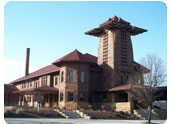
Greater Cincinnati Regional Profile
Encompassing three states and a number of counties in Southwest Ohio, Northern Kentucky, and Southeast Indiana, Greater Cincinnati is brimming over with delightful surprises. Nearly a dozen Fortune 500 companies, more than 300 foreign-owned firms, one of the world’s finest international airports, and sweeping riverfront revitalization are just a few of the highlights within this dynamic region. In addition, newcomers will find major-league sports attractions, a rich cultural community, a famous zoo, award-winning amusement centers, and outstanding art and history museums. The mix of rural communities with vibrant urban centers served by efficient transportation facilities ensures an atmosphere that excels in convenience and livability.